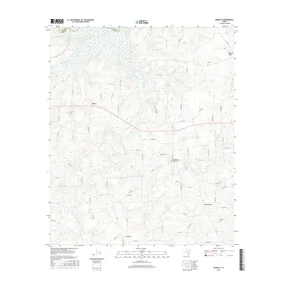
2016 Map of Marietta
USGS Topo · Published 2016About this map
The Sulphur River forms the northern boundary of this Cass County landscape, where the border with Bowie County is defined by the river’s winding course. This area of northeast Texas is characterized by a dense network of tributaries including Caney Cr, Mill Cr, and Elliot Cr that feed into the larger river basin. Small rural hubs such as Marietta and Nickleberry serve as focal points for a community connected by Farm to Market roads and numerous county routes. For those tracing local heritage, the map identifies several well-distributed burial grounds including Bethlehem Cem in the southeast and Creekmore Cem near Dalton. The proximity of settlements like Cornett and Bryans Mill to these waterways highlights the historical importance of the river drainage system in shaping the local geography and road network.
Find a feature on this map
71 named features on this map. Tap any name to fly to it.
Don’t see what you’re looking for? This feature index may not catch every label — zoom into the map to look around manually.
Map Details
Editions of this 2016 Marietta Map
This is the sole edition of this map. No revisions or reprints were ever made.
Other maps of this area

1909 · New Boston
USGS Topo · 1:62,500

1910 · Linden
USGS Topo · 1:62,500

1914 · Daingerfield
USGS Topo · 1:62,500

1930 · Bassett
USGS Topo · 1:62,500

1953 · Texarkana
USGS Topo · 1:250,000

1955 · Corley
USGS Topo · 1:24,000

1955 · New Boston
USGS Topo · 1:62,500

1956 · Texarkana
USGS Topo · 1:250,000

1964 · Daingerfield
USGS Topo · 1:24,000

1965 · Marietta
USGS Topo · 1:24,000