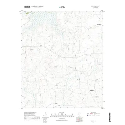
2019 Map of Marietta
USGS Topo · Published 2019About this map
The Sulphur River corridor defines the northern edge of this landscape at the junction of Bowie and Cass counties. The area is characterized by a network of small creeks and rural crossroads, with the town of Marietta situated near the center. Moving south and east, the map reveals several established communities including Bryans Mill, Dalton, Nickleberry, and Cornett. These settlements are connected by a system of Farm to Market roads like FM 1766 and FM 250, which navigate the various branches of Bear Cr and Mill Cr. For those researching local family history, several burial grounds are documented throughout the quadrangle, notably Bethlehem Cem, New Hope Cem, and Creekmore Cem. The presence of numerous family-named roads and rural infrastructure provides a clear view of the land division and local connectivity in this part of Northeast Texas during the late 2010s.
Find a feature on this map
72 named features on this map. Tap any name to fly to it.
Don’t see what you’re looking for? This feature index may not catch every label — zoom into the map to look around manually.
Map Details
Editions of this 2019 Marietta Map
This is the sole edition of this map. No revisions or reprints were ever made.
Other maps of this area

1909 · New Boston
USGS Topo · 1:62,500

1910 · Linden
USGS Topo · 1:62,500

1914 · Daingerfield
USGS Topo · 1:62,500

1930 · Bassett
USGS Topo · 1:62,500

1953 · Texarkana
USGS Topo · 1:250,000

1955 · Corley
USGS Topo · 1:24,000

1955 · New Boston
USGS Topo · 1:62,500

1956 · Texarkana
USGS Topo · 1:250,000

1964 · Daingerfield
USGS Topo · 1:24,000

1965 · Marietta
USGS Topo · 1:24,000