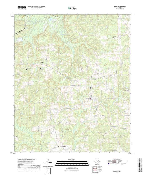
2022 Map of Marietta
USGS Topo · Published 2022About this map
The Sulphur River forms the northern boundary of this landscape in Cass County, where a network of rural roads connects several small, historic communities. The settlement of Marietta sits centrally, surrounded by a high concentration of family and community burial grounds, including Oakridge Cem and New Hope Cem. The terrain is defined by numerous drainage systems, such as Mill Cr, Elliot Cr, and Sweet Cr, which flow through the undulating countryside toward the river. To the north, Bryans Mill remains a distinct point of interest, while southern reaches are anchored by Cornett and its adjacent Cornett Cem. For those tracing family history, the map provides precise locations for Creekmore Cem, Dalton Cem, and Bethlehem Cem, reflecting the deep-rooted genealogical heritage of this Northeast Texas region.
Find a feature on this map
76 named features on this map. Tap any name to fly to it.
Don’t see what you’re looking for? This feature index may not catch every label — zoom into the map to look around manually.
Map Details
Editions of this 2022 Marietta Map
This is the sole edition of this map. No revisions or reprints were ever made.
Other maps of this area

1909 · New Boston
USGS Topo · 1:62,500

1910 · Linden
USGS Topo · 1:62,500

1914 · Daingerfield
USGS Topo · 1:62,500

1930 · Bassett
USGS Topo · 1:62,500

1953 · Texarkana
USGS Topo · 1:250,000

1955 · Corley
USGS Topo · 1:24,000

1955 · New Boston
USGS Topo · 1:62,500

1956 · Texarkana
USGS Topo · 1:250,000

1964 · Daingerfield
USGS Topo · 1:24,000

1965 · Marietta
USGS Topo · 1:24,000