
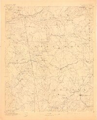
1895 Map of Marietta
USGS Topo · Published 1895About this map
The Chattahoochee River carves a winding path through this West Georgia landscape, serving as a primary corridor for transit and industry during the late 19th century. Surveyed in the late 1880s, the terrain shows a transition from the established railroad hubs like Marietta and Douglasville to the more rural river crossings and family settlements. The river is notably lined with numerous private crossings such as the Campbellton Ferry, Addhold Ferry, and Smith Ferry, which preceded the widespread construction of bridges.
Find a feature on this map
107 named features on this map. Tap any name to fly to it.
Don’t see what you’re looking for? This feature index may not catch every label — zoom into the map to look around manually.
Map Details
Editions of this 1895 Marietta Map
This is the sole edition of this map. No revisions or reprints were ever made.
Other maps of this area

1886 · Rome
USGS Topo · 1:125,000

1888 · Atlanta
USGS Topo · 1:125,000

1889 · Tallapoosa
USGS Topo · 1:125,000

1890 · Suwanee
USGS Topo · 1:125,000

1890 · Cartersville
USGS Topo · 1:125,000

1890 · Atlanta
USGS Topo · 1:125,000

1891 · Marietta
USGS Topo · 1:125,000

1891 · Cartersville
USGS Topo · 1:125,000
1892 · Tallapoosa
USGS Topo · 1:125,000

1892 · Atlanta
USGS Topo · 1:125,000