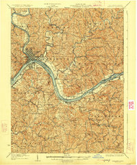
1927 Map of Marietta
USGS Topo · Published 1927About this map
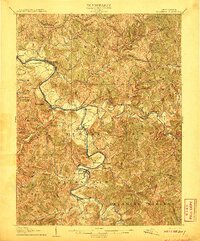
The Ohio River and Muskingum River converge at Marietta, anchoring a landscape defined by early 20th-century river commerce and rail transport. This survey, with culture revised in the mid-1920s, shows the intricate network of the Baltimore and Ohio RR and Kanawha and Michigan RR servicing riverfront towns like Williamstown and Harmar. A high concentration of rural institutions—ranging from the curiously named Last Chance School and Rising Sun School to remote congregations like Burnt Hill Church—indicates a densely settled backcountry. The map documents the vital role of water navigation through the Steamboat Route and infrastructure like Lock No 2, while topographic details such as Buckley Island and the heights of Harmar Ridge illustrate the complex geography of the Mid-Ohio Valley.
Find a feature on this map
112 named features on this map. Tap any name to fly to it.
Don’t see what you’re looking for? This feature index may not catch every label — zoom into the map to look around manually.
Map Details
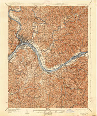
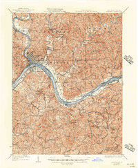
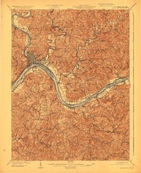
Editions of this 1927 Marietta Map
3 editions found
Other maps of this area

1902 · Parkersburg
USGS Topo · 1:62,500

1903 · Macksburg
USGS Topo · 1:62,500

1904 · Parkersburg
USGS Topo · 1:62,500
1904 · Marietta
USGS Topo · 1:62,500

1905 · New Matamoras
USGS Topo · 1:62,500

1905 · Macksburg
USGS Topo · 1:62,500

1906 · Saint Marys
USGS Topo · 1:62,500
1906 · Elizabeth
USGS Topo · 1:62,500

1906 · Belleville
USGS Topo · 1:62,500

1907 · Harrisville
USGS Topo · 1:62,500