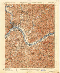
1927 Map of Marietta
USGS Topo · Published 1938About this map
The Ohio River dominates this mid-1920s landscape, serving as a vital corridor between Ohio and West Virginia where the Muskingum River joins from the north. At this confluence, the city of Marietta and its neighbor Harmar sit across from Williamstown, forming a concentrated hub of commerce and transit. The Baltimore and Ohio RR and the Northwestern Turnpike underscore the area's importance as a transportation gateway. Beyond the river banks, the terrain is densely marked by a network of rural ridge-top and valley communities such as Newlandsville and Sandhill. This survey reveals a remarkably dense social infrastructure for a rural river valley, documented through numerous named schools and churches like Pigeonroost Run School, Social Chapel, and Burnt Hill Church. The presence of small settlements like Rainbow and Caywood alongside winding waterways like Duck Creek and Cow Run illustrates a pattern of early twentieth-century life deeply connected to the local topography and river-based economy.
Find a feature on this map
74 named features on this map. Tap any name to fly to it.
Don’t see what you’re looking for? This feature index may not catch every label — zoom into the map to look around manually.
Map Details
Editions of this 1927 Marietta Map
3 editions found

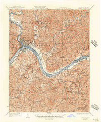
Other maps of this area

1902 · Parkersburg
USGS Topo · 1:62,500

1903 · Macksburg
USGS Topo · 1:62,500

1904 · Parkersburg
USGS Topo · 1:62,500

1904 · Marietta
USGS Topo · 1:62,500

1905 · New Matamoras
USGS Topo · 1:62,500

1905 · Macksburg
USGS Topo · 1:62,500

1906 · Saint Marys
USGS Topo · 1:62,500

1906 · Elizabeth
USGS Topo · 1:62,500

1906 · Belleville
USGS Topo · 1:62,500

1907 · Harrisville
USGS Topo · 1:62,500