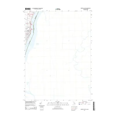
2014 Map of Marine City OE E
USGS Topo · Published 2014About this map
Marine City sits along the western bank of the St. Clair River, serving as a vital point of transit on the international border between Michigan and Canada. The 2014 landscape shows a concentrated urban grid defined by streets such as Woodworth St and Pointe Dr, which trace the river's edge. This riverfront orientation underscores the town's enduring relationship with the Great Lakes waterway system, even as modern infrastructure like Belle River Rd connects the interior. On the northern outskirts, the Woodlawn Cem remains a significant local landmark for genealogists and residents. Beyond the immediate settlement of Marine City, the map highlights the large expanse of the Saint Clair River, illustrating the scale of this maritime corridor that separates St. Clair Co from its neighbors to the east.
Find a feature on this map
24 named features on this map. Tap any name to fly to it.
Don’t see what you’re looking for? This feature index may not catch every label — zoom into the map to look around manually.
Map Details
Editions of this 2014 Marine City OE E Map
This is the sole edition of this map. No revisions or reprints were ever made.
Other maps of this area

1912 · Port Huron
USGS Topo · 1:62,500

1914 · Algonac
USGS Topo · 1:62,500

1928 · Hicky
USGS Topo · 1:62,500

1929 · Port Huron
USGS Topo · 1:62,500

1936 · St. Clair
USGS Topo · 1:31,680

1936 · Rattle Run
USGS Topo · 1:31,680

1936 · Algonac
USGS Topo · 1:31,680

1939 · St. Clair
USGS Topo · 1:24,000

1939 · Marine City
USGS Topo · 1:24,000
1939 · Algonac
USGS Topo · 1:24,000