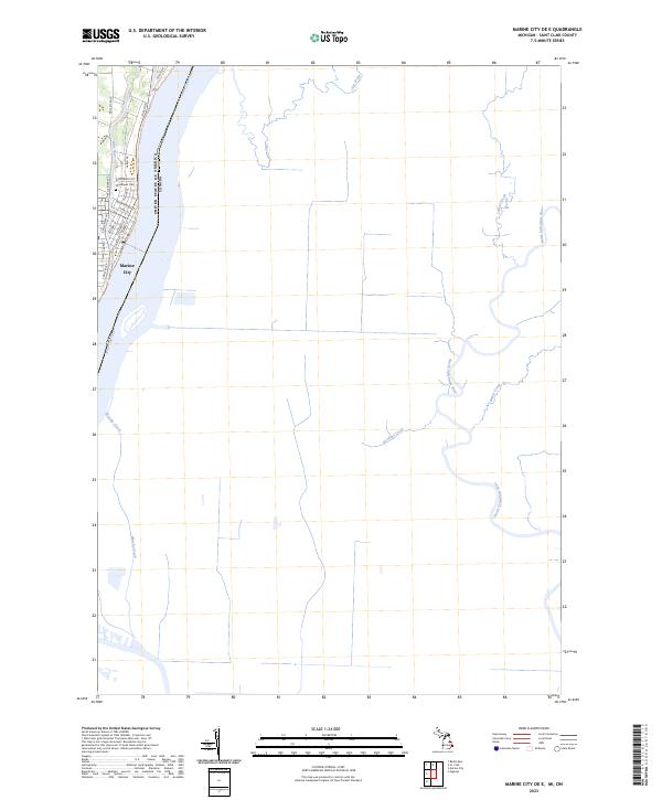
2023 Map of Marine City OE E
USGS Topo · Published 2023About this map
Marine City stands as the primary riverfront settlement on this portion of the Saint Clair River, where the Belle River joins the larger waterway. This 2023 survey illustrates the dense residential grid of the town, including streets like Woodworth St and Pearl St, and the local Woodlawn Cem. The international boundary between the United States of America and Canada runs down the center of the river, highlighting the region's importance as a border corridor. Moving inland, the landscape is defined by a network of drainage ways and smaller tributaries such as Clay Creek, Indian Creek, and the North Sydenham River. The map provides a contemporary record of land divisions across several townships including t4n r17e and t3n r16e, showing how the modern road network follows the historic section lines established by early surveys.
Find a feature on this map
29 named features on this map. Tap any name to fly to it.
Don’t see what you’re looking for? This feature index may not catch every label — zoom into the map to look around manually.
Map Details
Editions of this 2023 Marine City OE E Map
This is the sole edition of this map. No revisions or reprints were ever made.
Other maps of this area

1912 · Port Huron
USGS Topo · 1:62,500

1914 · Algonac
USGS Topo · 1:62,500

1928 · Hicky
USGS Topo · 1:62,500

1929 · Port Huron
USGS Topo · 1:62,500

1936 · St. Clair
USGS Topo · 1:31,680

1936 · Rattle Run
USGS Topo · 1:31,680

1936 · Algonac
USGS Topo · 1:31,680

1939 · St. Clair
USGS Topo · 1:24,000

1939 · Marine City
USGS Topo · 1:24,000
1939 · Algonac
USGS Topo · 1:24,000