2015 Map of Maringouin
USGS Topo · Published 2015About this map
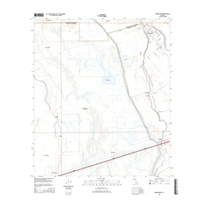
Maringouin and its surrounding wetlands occupy a critical drainage landscape at the boundary of Pointe Coupee and Iberville Parishes. This 2015 survey illustrates a terrain defined by the complex hydrology of the Atchafalaya Basin Floodway, where water bodies like Bayou Des Glaises and the East Fork Bayou Des Glaises wind through the low-lying alluvial plains. The settlement pattern follows the high ground along Bayou Grosse Tete, with the community of Musson and several local burial sites, including Saint Peter Cemetery and New Zion Cemetery, clustered near the natural levees. Transportation infrastructure such as Railroad Drive and Interstate 10 cut across the basin, providing modern transit through an area historically reliant on bayous and ditches like the King Ditch. Small landforms like Big Island and Tight Island rise above the surrounding chutes, reflecting the shifting nature of this river-driven geography.
Find a feature on this map
57 named features on this map. Tap any name to fly to it.
Don’t see what you’re looking for? This feature index may not catch every label — zoom into the map to look around manually.
Map Details
Editions of this 2015 Maringouin Map
This is the sole edition of this map. No revisions or reprints were ever made.
Other maps of this area

1906 · Bayou Sara
USGS Topo · 1:125,000

1935 · Osca Bayou
USGS Topo · 1:62,500

1939 · Fordoche
USGS Topo · 1:62,500

1940 · Grosse Tete
USGS Topo · 1:62,500

1953 · Cow Bayou
USGS Topo · 1:24,000

1953 · Maringouin
USGS Topo · 1:24,000

1953 · Grosse Tete SW
USGS Topo · 1:24,000

1954 · Fordoche
USGS Topo · 1:24,000

1954 · Erwinville
USGS Topo · 1:24,000

1954 · Grosse Tete
USGS Topo · 1:24,000