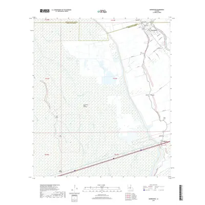
2018 Map of Maringouin
USGS Topo · Published 2018About this map
Bayou Grosse Tete defines the eastern corridor of this Iberville Parish landscape, where the settlement of Maringouin serves as a local hub. The map reveals a dense concentration of cultural and genealogical sites, particularly along Bayou Rd, where numerous historic congregations and burial grounds like Immaculate Heart of Mary Cem and Greater Bethany Baptist Cem are situated. Further south, the communities of Musson and Ramah flank the waterway, while the western portion of the quadrangle is dominated by the complex hydrology of the Atchafalaya Basin Floodway. This area is marked by a network of smaller streams including Bayou Black, Dixie Bayou, and Bayou Blue. The presence of features such as Tight Island and Big Island within the Des Glaises Swamp illustrates the seasonally saturated nature of this lowland environment. Transport infrastructure, from Railroad Dr to the modern span of Interstate 10 crossing near Des Glaise, highlights the region's role as a transit point between the basin and the capital region.
Find a feature on this map
58 named features on this map. Tap any name to fly to it.
Don’t see what you’re looking for? This feature index may not catch every label — zoom into the map to look around manually.
Map Details
Editions of this 2018 Maringouin Map
This is the sole edition of this map. No revisions or reprints were ever made.
Other maps of this area

1906 · Bayou Sara
USGS Topo · 1:125,000

1935 · Osca Bayou
USGS Topo · 1:62,500

1939 · Fordoche
USGS Topo · 1:62,500

1940 · Grosse Tete
USGS Topo · 1:62,500

1953 · Cow Bayou
USGS Topo · 1:24,000

1953 · Maringouin
USGS Topo · 1:24,000

1953 · Grosse Tete SW
USGS Topo · 1:24,000

1954 · Fordoche
USGS Topo · 1:24,000

1954 · Erwinville
USGS Topo · 1:24,000

1954 · Grosse Tete
USGS Topo · 1:24,000