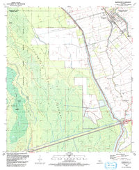
1992 Map of Maringouin
USGS Topo · Published 1992About this map
Atchafalaya National Wildlife Refuge dominates the western portion of this landscape, a complex environment of bayous and chutes within the Atchafalaya Basin Floodway. The terrain is defined by its hydrology, where features like Bayou des Ourses and Big Island Chute navigate around the high ground of Big Island. To the east, the East Atchafalaya Basin Protection Levee creates a stark boundary between the wild wetlands and the developed corridor along Bayou Grosse Tete.
Find a feature on this map
43 named features on this map. Tap any name to fly to it.
Don’t see what you’re looking for? This feature index may not catch every label — zoom into the map to look around manually.
Map Details
Editions of this 1992 Maringouin Map
This is the sole edition of this map. No revisions or reprints were ever made.
Other maps of this area

1906 · Bayou Sara
USGS Topo · 1:125,000

1935 · Osca Bayou
USGS Topo · 1:62,500

1939 · Fordoche
USGS Topo · 1:62,500

1940 · Grosse Tete
USGS Topo · 1:62,500

1953 · Cow Bayou
USGS Topo · 1:24,000

1953 · Maringouin
USGS Topo · 1:24,000

1953 · Grosse Tete SW
USGS Topo · 1:24,000

1954 · Fordoche
USGS Topo · 1:24,000

1954 · Erwinville
USGS Topo · 1:24,000

1954 · Grosse Tete
USGS Topo · 1:24,000