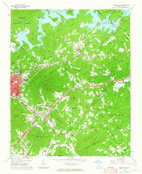
1962 Map of Marion East
USGS Topo · Published 1964About this map
Lake James dominates the northern reaches of this landscape, where the Catawba River and Linville River converge at the foot of the Pisgah National Forest. The 1960s terrain is characterized by a dense network of mountain streams and named peaks, including Gibbs Mtn and Higgins Mountain, which separate the river valley from the rolling foothills to the south. Transportation is defined by the heavy infrastructure of the Clinchfield RR and the Southern RR, which converge near Marion and East Marion. Small communities and family landmarks are scattered throughout the hills, from the cluster at Nebo to the crossroads at Dysartsville. Local genealogy is well-documented through numerous rural institutions like Bethel Ch, Rolands Chapel, and several burial grounds including Conley Chapel Cem and Oak Grove Cem.
Find a feature on this map
81 named features on this map. Tap any name to fly to it.
Don’t see what you’re looking for? This feature index may not catch every label — zoom into the map to look around manually.
Map Details
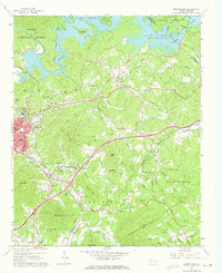
Editions of this 1962 Marion East Map
2 editions found
Other maps of this area

1900 · Mount Mitchell
USGS Topo · 1:125,000

1902 · Mount Mitchell
USGS Topo · 1:125,000

1905 · Morganton
USGS Topo · 1:125,000

1953 · Charlotte
USGS Topo · 1:250,000

1954 · Charlotte
USGS Topo · 1:250,000

1955 · Knoxville
USGS Topo · 1:250,000

1956 · Oak Hill
USGS Topo · 1:24,000

1956 · Ashford
USGS Topo · 1:24,000

1956 · Linville Falls
USGS Topo · 1:62,500

1957 · Knoxville
USGS Topo · 1:250,000