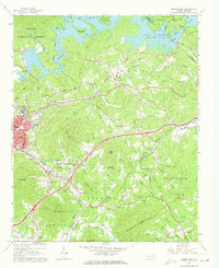
1962 Map of Marion East
USGS Topo · Published 1973About this map
The eastern outskirts of Marion and the rising peaks of the Pisgah National Forest characterize this McDowell County landscape in the early 1960s. The northern reaches are dominated by the winding shorelines of Lake James and the Catawba River, where the Burke Co McDowell Co line crosses the water. Industrial and transportation hubs like the Clinchfield Railroad and the Southern railway converge near East Marion, supporting a region defined by both mountain topography and growing rail infrastructure.
Find a feature on this map
82 named features on this map. Tap any name to fly to it.
Don’t see what you’re looking for? This feature index may not catch every label — zoom into the map to look around manually.
Map Details
Editions of this 1962 Marion East Map
2 editions found
Other maps of this area

1900 · Mount Mitchell
USGS Topo · 1:125,000

1902 · Mount Mitchell
USGS Topo · 1:125,000

1905 · Morganton
USGS Topo · 1:125,000

1953 · Charlotte
USGS Topo · 1:250,000

1954 · Charlotte
USGS Topo · 1:250,000

1955 · Knoxville
USGS Topo · 1:250,000

1956 · Oak Hill
USGS Topo · 1:24,000

1956 · Ashford
USGS Topo · 1:24,000

1956 · Linville Falls
USGS Topo · 1:62,500

1957 · Knoxville
USGS Topo · 1:250,000