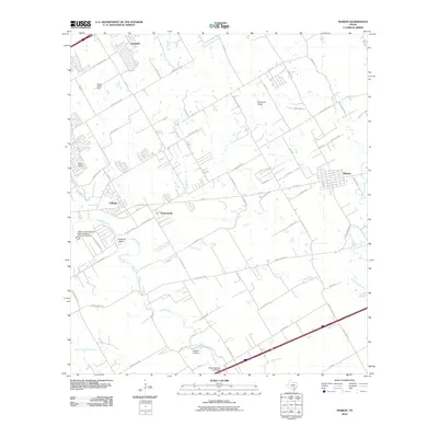
2010 Map of Marion
USGS Topo · Published 2010About this map
Cibolo Creek meanders through this landscape, providing a natural boundary between evolving residential developments and traditional agricultural tracts. The area is anchored by several distinct communities, ranging from the established town of Marion in the east to the growing centers of Cibolo and Haeckerville. Evidence of the region’s rural past and aviation history is scattered across the terrain, including Kardys Airport and the H M Ranch Airport. Local history and genealogy researchers will find significant landmarks such as the Stappers Cemetery and Green Valley Farm amidst the network of farm-to-market roads and newer suburban streets like Scenic Hill Ln and Lost Meadows Dr. The presence of the Cibolo Creek Municipal Authority Water Treatment Facility and the State Highway 3-A Bridge highlights the critical infrastructure supporting the transition of these South Texas prairie lands.
Find a feature on this map
63 named features on this map. Tap any name to fly to it.
Don’t see what you’re looking for? This feature index may not catch every label — zoom into the map to look around manually.
Map Details
Editions of this 2010 Marion Map
This is the sole edition of this map. No revisions or reprints were ever made.
Other maps of this area

1924 · New Braunfels No 4
USGS Topo · 1:48,000

1925 · New Braunfels No 1
USGS Topo · 1:48,000

1927 · New Braunfels
USGS Topo · 1:62,500

1953 · Schertz
USGS Topo · 1:24,000

1953 · Bat Cave
USGS Topo · 1:24,000

1953 · Martinez
USGS Topo · 1:24,000

1954 · San Antonio
USGS Topo · 1:250,000

1957 · San Antonio
USGS Topo · 1:250,000

1957 · New Berlin
USGS Topo · 1:24,000

1958 · Marion
USGS Topo · 1:24,000