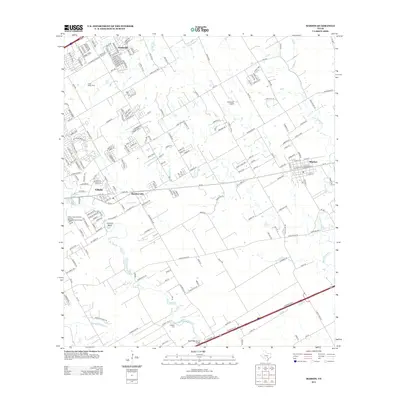
2013 Map of Marion
USGS Topo · Published 2013About this map
The town of Marion serves as a prominent landmark on this 2013 map, featuring a dense grid of streets like W Seguin St and E Otto St. To the west, the growing community of Cibolo and the settlement at Haeckerville show the transition from agricultural land to residential development. The landscape is defined by the winding course of Cibolo Cr and its tributaries, including East Dietz Creek and Womans Hollow Cr.
Find a feature on this map
198 named features on this map. Tap any name to fly to it.
Don’t see what you’re looking for? This feature index may not catch every label — zoom into the map to look around manually.
Map Details
Editions of this 2013 Marion Map
This is the sole edition of this map. No revisions or reprints were ever made.
Other maps of this area

1924 · New Braunfels No 4
USGS Topo · 1:48,000

1925 · New Braunfels No 1
USGS Topo · 1:48,000

1927 · New Braunfels
USGS Topo · 1:62,500

1953 · Schertz
USGS Topo · 1:24,000

1953 · Bat Cave
USGS Topo · 1:24,000

1953 · Martinez
USGS Topo · 1:24,000

1954 · San Antonio
USGS Topo · 1:250,000

1957 · San Antonio
USGS Topo · 1:250,000

1957 · New Berlin
USGS Topo · 1:24,000

1958 · Marion
USGS Topo · 1:24,000