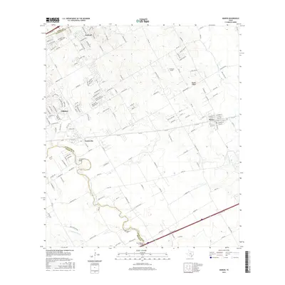
2016 Map of Marion
USGS Topo · Published 2016About this map
Cibolo Cr and Santa Clara Cr carve through the landscape of the Texas hill country transition, defining the boundaries and drainage patterns for a series of growing communities. The settlement of Marion sits as a central hub near the rail lines, surrounded by smaller locales like Santa Clara, Haeckerville, and Northcliff. This 2016 survey captures the area during a period of significant suburban expansion, where residential street grids like Turning Stone and Crusader Bend begin to overlay the traditional farm-to-market road system.
Find a feature on this map
161 named features on this map. Tap any name to fly to it.
Don’t see what you’re looking for? This feature index may not catch every label — zoom into the map to look around manually.
Map Details
Editions of this 2016 Marion Map
This is the sole edition of this map. No revisions or reprints were ever made.
Other maps of this area

1924 · New Braunfels No 4
USGS Topo · 1:48,000

1925 · New Braunfels No 1
USGS Topo · 1:48,000

1927 · New Braunfels
USGS Topo · 1:62,500

1953 · Schertz
USGS Topo · 1:24,000

1953 · Bat Cave
USGS Topo · 1:24,000

1953 · Martinez
USGS Topo · 1:24,000

1954 · San Antonio
USGS Topo · 1:250,000

1957 · San Antonio
USGS Topo · 1:250,000

1957 · New Berlin
USGS Topo · 1:24,000

1958 · Marion
USGS Topo · 1:24,000