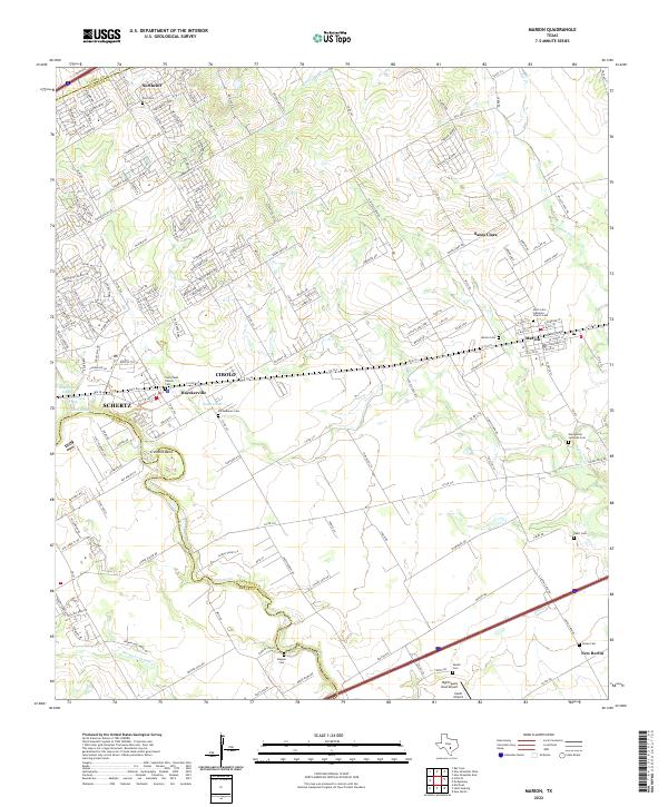
2022 Map of Marion
USGS Topo · Published 2022About this map
The winding course of Cibolo Cr forms the boundary between Guadalupe and Bexar Counties, anchoring a landscape where rural heritage and expanding residential footprints meet. This 2022 survey documents the corridor through Schertz, Cibolo, and Marion, where the Union Pacific railroad line continues to serve as a primary transit spine. The area is exceptionally dense with small family and church burial grounds, reflecting the deep nineteenth-century German-Texan roots of the region. Genealogists will find a wealth of local landmarks such as Vordenbaum Cem, Stapper Cem, and the Saint John Lutheran Church Cem. Small aviation hubs like Zuehl Airport and Nighthawk's Nest Airport dot the fields south of the primary settlements, while the northern corner near Northcliff shows the modern suburban street patterns evolving from former agricultural land.
Find a feature on this map
189 named features on this map. Tap any name to fly to it.
Don’t see what you’re looking for? This feature index may not catch every label — zoom into the map to look around manually.
Map Details
Editions of this 2022 Marion Map
This is the sole edition of this map. No revisions or reprints were ever made.
Other maps of this area

1924 · New Braunfels No 4
USGS Topo · 1:48,000

1925 · New Braunfels No 1
USGS Topo · 1:48,000

1927 · New Braunfels
USGS Topo · 1:62,500

1953 · Schertz
USGS Topo · 1:24,000

1953 · Bat Cave
USGS Topo · 1:24,000

1953 · Martinez
USGS Topo · 1:24,000

1954 · San Antonio
USGS Topo · 1:250,000

1957 · San Antonio
USGS Topo · 1:250,000

1957 · New Berlin
USGS Topo · 1:24,000

1958 · Marion
USGS Topo · 1:24,000