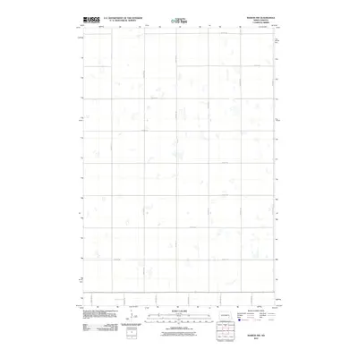
2011 Map of Marion NW
USGS Topo · Published 2011About this map
Meadow Lake Township in Barnes County is defined by a rigorous section-line grid and numerous small, unnamed wetlands and prairie potholes. This rural landscape, captured in the early 21st century, showcases the enduring agricultural layout of the North Dakota plains. The map is dominated by a systematic network of thoroughfares such as 48th St SE, 50th St SE, and 96th Ave SE. Unlike many earlier topographic surveys, this edition illustrates the modern road classification system, distinguishing between local roads and 4WD tracks that traverse the open fields. The absence of named settlements or civic institutions highlights the strictly agrarian nature of this specific quadrangle, making it a valuable reference for understanding contemporary land use and the persistence of early surveying patterns in the region.
Find a feature on this map
15 named features on this map. Tap any name to fly to it.
Don’t see what you’re looking for? This feature index may not catch every label — zoom into the map to look around manually.
Map Details
Editions of this 2011 Marion NW Map
This is the sole edition of this map. No revisions or reprints were ever made.
Other maps of this area

1896 · Jamestown
USGS Topo · 1:125,000

1897 · Eckelson
USGS Topo · 1:125,000

1952 · Ypsilanti
USGS Topo · 1:24,000

1952 · Dickey
USGS Topo · 1:24,000

1953 · Jamestown
USGS Topo · 1:250,000

1953 · Montpelier
USGS Topo · 1:24,000

1953 · Adrian
USGS Topo · 1:24,000

1956 · Jamestown
USGS Topo · 1:250,000

1970 · Marion NE
USGS Topo · 1:24,000
1970 · Marion NW
USGS Topo · 1:24,000
Featured Places
- Meadow Lake Township, ND
- Greenland Township, ND
- Saratoga Township, ND
- Sheridan Township, ND
- Stutsman County, ND