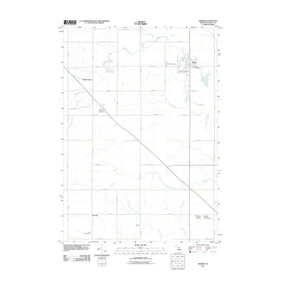
2011 Map of Marion
USGS Topo · Published 2011About this map
The Middle Branch River and its various tributaries, including Appleby Creek and Crocker Creek, define the rural geography of Osceola County in this 2011 survey. The village of Marion serves as the primary hub, where the Mill Pond and Marion Fairgrounds sit near the center of a grid-like road network. To the southwest, the smaller settlement of Avondale is situated along the rural section of 80th Avenue, reflecting the area's dispersed agricultural character.
Find a feature on this map
45 named features on this map. Tap any name to fly to it.
Don’t see what you’re looking for? This feature index may not catch every label — zoom into the map to look around manually.
Map Details
Editions of this 2011 Marion Map
This is the sole edition of this map. No revisions or reprints were ever made.
Other maps of this area

1954 · Traverse City
USGS Topo · 1:250,000

1954 · Midland
USGS Topo · 1:250,000

1957 · Cadillac South
USGS Topo · 1:62,500

1957 · Marion
USGS Topo · 1:62,500

1958 · Traverse City
USGS Topo · 1:250,000

1958 · Midland
USGS Topo · 1:250,000

1959 · Midland
USGS Topo · 1:250,000

1959 · Lake
USGS Topo · 1:62,500

1959 · Evart
USGS Topo · 1:62,500

1966 · Midland
USGS Topo · 1:250,000