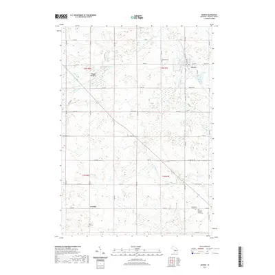
2019 Map of Marion
USGS Topo · Published 2019About this map
Marion sits at the intersection of local commerce and the winding Middle Br River in this 2019 survey of Osceola County. The village serves as a clear hub for the surrounding agricultural and wetland landscape, with streets like E Main St and S Mill St defining its core. To the southwest, the settlement of Avondale marks a smaller node of activity near the headwaters of Whetstone Cr. The terrain is characterized by subtle elevations like Pisgah Heights and numerous watercourses including Crocker Cr and Appleby Cr. For genealogists and local historians, the map is a primary source for locating resting places such as the Middle Branch Township Cem and the Methodist Episcopal Church Cem, alongside rural landmarks like Cherry Valley Cem and Greenwood Cem.
Find a feature on this map
52 named features on this map. Tap any name to fly to it.
Don’t see what you’re looking for? This feature index may not catch every label — zoom into the map to look around manually.
Map Details
Editions of this 2019 Marion Map
This is the sole edition of this map. No revisions or reprints were ever made.
Other maps of this area

1954 · Traverse City
USGS Topo · 1:250,000

1954 · Midland
USGS Topo · 1:250,000

1957 · Cadillac South
USGS Topo · 1:62,500

1957 · Marion
USGS Topo · 1:62,500

1958 · Traverse City
USGS Topo · 1:250,000

1958 · Midland
USGS Topo · 1:250,000

1959 · Midland
USGS Topo · 1:250,000

1959 · Lake
USGS Topo · 1:62,500

1959 · Evart
USGS Topo · 1:62,500

1966 · Midland
USGS Topo · 1:250,000