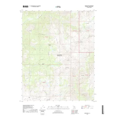
2018 Map of Marion Peak
USGS Topo · Published 2018About this map
Kings Canyon National Park encompasses this high-altitude landscape, where the Middle Fork Kings River carves through the northwestern corner of the quadrangle. The terrain is defined by the massive granite uplift of the Monarch Divide and Cirque Crest, creating a sanctuary of alpine basins and glacially-carved valleys. Recreation and travel are represented by the State Lakes Loop trail, which provides access to remote water bodies like the State Lakes and Horseshoe Lakes.
Find a feature on this map
46 named features on this map. Tap any name to fly to it.
Don’t see what you’re looking for? This feature index may not catch every label — zoom into the map to look around manually.
Map Details
Editions of this 2018 Marion Peak Map
This is the sole edition of this map. No revisions or reprints were ever made.
Other maps of this area

1903 · Tehipite
USGS Topo · 1:125,000

1905 · Tehipite
USGS Topo · 1:125,000

1907 · Mt. Whitney
USGS Topo · 1:125,000

1912 · Mt. Goddard
USGS Topo · 1:125,000

1913 · Bishop
USGS Topo · 1:125,000

1919 · Mt. Whitney
USGS Topo · 1:125,000

1937 · Mt. Whitney
USGS Topo · 1:125,000

1947 · Mariposa
USGS Topo · 1:250,000

1948 · Fresno
USGS Topo · 1:250,000

1948 · Mariposa
USGS Topo · 1:250,000