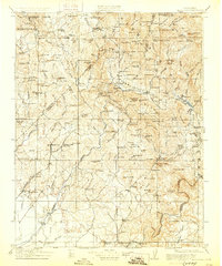
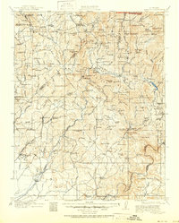
1912 Map of Mariposa
USGS Topo · Published 1928About this map
Mariposa Grove Big Trees stands at the northern edge of this survey, marking the transition from the high Sierra foothills toward the developing ranchlands and mining districts of the Central Valley. The landscape is a network of mid-elevation economies, where the Southern Pacific line terminates at Raymond, a vital shipping point for the nearby Marble Quarry at Knowles. Along the Chowchilla River and Fresno River, the map documents a transition from old camps to established settlements like Coarse Gold and Fresno Flats. This 1910s era shows an active industrial footprint, from the Standard Mill and Texas Flat Mine to the early hydroelectric infrastructure of the Powerhouse on the San Joaquin. Pockets of social history are visible in the many rural schoolhouses, such as Oakvale School and Dennis School, and the designated Indian Settlement near the Fresno River.
Find a feature on this map
143 named features on this map. Tap any name to fly to it.
Don’t see what you’re looking for? This feature index may not catch every label — zoom into the map to look around manually.
Map Details
Editions of this 1912 Mariposa Map
6 editions found

Other maps of this area

1893 · Sonora
USGS Topo · 1:125,000

1896 · Sonora
USGS Topo · 1:125,000

1897 · Sonora
USGS Topo · 1:125,000

1897 · Yosemite
USGS Topo · 1:125,000

1898 · Sonora
USGS Topo · 1:125,000

1900 · Yosemite
USGS Topo · 1:125,000

1901 · Mt. Lyell
USGS Topo · 1:125,000

1903 · Yosemite
USGS Topo · 1:125,000

1904 · Kaiser
USGS Topo · 1:125,000

1909 · Yosemite
USGS Topo · 1:125,000