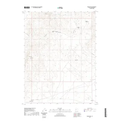
2020 Map of Marjum Pass
USGS Topo · Published 2020About this map
Howell Peak and the Middle Range dominate this corner of Millard County, where the topography of the Great Basin is defined by steep ridges and deep drainages. This high-desert landscape is punctuated by geological curiosities like the Trilobite Beds and the Wheeler Amphitheater, suggesting a terrain shaped by ancient seabed deposits now exposed in the arid climate. Water is a critical and sparse resource here, represented by isolated points like Stove Spring and Wildhorse Spring.
Find a feature on this map
15 named features on this map. Tap any name to fly to it.
Don’t see what you’re looking for? This feature index may not catch every label — zoom into the map to look around manually.
Map Details
Editions of this 2020 Marjum Pass Map
This is the sole edition of this map. No revisions or reprints were ever made.
Other maps of this area

1908 · Fish Springs
USGS Topo · 1:250,000

1910 · Fish Springs
USGS Topo · 1:250,000

1953 · Delta
USGS Topo · 1:250,000

1958 · Delta
USGS Topo · 1:250,000

1960 · Notch Peak
USGS Topo · 1:62,500

1962 · Delta
USGS Topo · 1:250,000

1972 · Whirlwind Valley SW
USGS Topo · 1:24,000

1972 · Swasey Peak SW
USGS Topo · 1:24,000

1972 · Long Ridge Reservoir
USGS Topo · 1:24,000
1972 · Swasey Peak
USGS Topo · 1:24,000