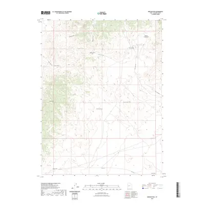
2023 Map of Marjum Pass
USGS Topo · Published 2023About this map
Trilobite Beds lie at the northern edge of this high-desert landscape in the Swasey Mtn area, marking a site of significant geological interest. The terrain is defined by the sharp verticality of the Middle Range, connecting prominent elevations such as Howell Peak and Antelope Mtn. These peaks overlook deep incisions in the earth including Sinbad Canyon and Wildhorse Canyon.
Find a feature on this map
16 named features on this map. Tap any name to fly to it.
Don’t see what you’re looking for? This feature index may not catch every label — zoom into the map to look around manually.
Map Details
Editions of this 2023 Marjum Pass Map
This is the sole edition of this map. No revisions or reprints were ever made.
Other maps of this area

1908 · Fish Springs
USGS Topo · 1:250,000

1910 · Fish Springs
USGS Topo · 1:250,000

1953 · Delta
USGS Topo · 1:250,000

1958 · Delta
USGS Topo · 1:250,000

1960 · Notch Peak
USGS Topo · 1:62,500

1962 · Delta
USGS Topo · 1:250,000

1972 · Whirlwind Valley SW
USGS Topo · 1:24,000

1972 · Swasey Peak SW
USGS Topo · 1:24,000

1972 · Long Ridge Reservoir
USGS Topo · 1:24,000
1972 · Swasey Peak
USGS Topo · 1:24,000