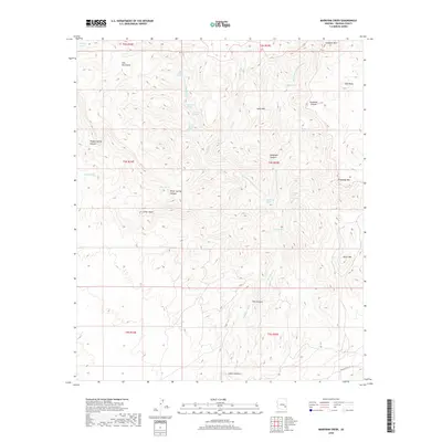
2018 Map of Markham Creek
USGS Topo · Published 2018About this map
The Gila Mountains dominate this high-desert landscape in Graham County, where a complex system of seasonal water sources sustained early ranching and travel. Numerous named springs, such as Line Camp Spring, Ash Timber Spring, and Angel Trail Spring, are scattered across the drainage basins of Left Fork Markham Cr and Right Fork Markham Cr. These water points, along with Goat Spring and Bull Springs, indicate a history of livestock management in a demanding environment. Notable landmarks like Table Mtn and Oliver Knoll rise above the deep cuts of Teague Spring Canyon and Deadman Canyon. To the south, Markham Cr flows through a distinctive geological pinch point known as The Narrows before transitioning into Markham Wash. The presence of Black Point Rd near Lopas Canyon provides one of the few improved access points into this network of ridges and canyons.
Find a feature on this map
39 named features on this map. Tap any name to fly to it.
Don’t see what you’re looking for? This feature index may not catch every label — zoom into the map to look around manually.
Map Details
Editions of this 2018 Markham Creek Map
This is the sole edition of this map. No revisions or reprints were ever made.
Other maps of this area

1954 · Silver City
USGS Topo · 1:250,000

1954 · Clifton
USGS Topo · 1:250,000

1957 · Clifton
USGS Topo · 1:250,000

1958 · Silver City
USGS Topo · 1:250,000

1958 · Clifton
USGS Topo · 1:250,000

1960 · Thatcher
USGS Topo · 1:62,500

1960 · Fort Thomas
USGS Topo · 1:62,500

1960 · Safford
USGS Topo · 1:62,500

1962 · Silver City
USGS Topo · 1:250,000

1962 · Clifton
USGS Topo · 1:250,000