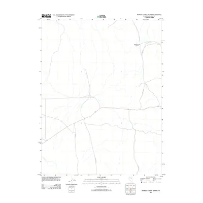
2012 Map of Marking Corral Summit
USGS Topo · Published 2012About this map
Marking Corral Summit stands as the central topographic feature in this high-altitude landscape of White Pine County, recorded during a 2012 survey. The area is defined by a sparse but essential network of rural routes, including Thirtymile Rd and Bothwick Rd, which trace the natural contours of the basin and range terrain. These roads indicate a history of land management and transit through this part of the Great Basin, where water sources like Summit Spring and the drainage of Illipah Creek dictate the patterns of human activity. The map reveals the layout of local infrastructure, including Co Rd 17 and Jakes Wash Rd, which serve as vital connectors in a territory where elevation and access to seasonal water define the utility of the land.
Find a feature on this map
7 named features on this map. Tap any name to fly to it.
Don’t see what you’re looking for? This feature index may not catch every label — zoom into the map to look around manually.
Map Details
Editions of this 2012 Marking Corral Summit Map
This is the sole edition of this map. No revisions or reprints were ever made.
Other maps of this area

1951 · Illipah
USGS Topo · 1:62,500

1956 · Ely
USGS Topo · 1:250,000

1958 · Reipetown
USGS Topo · 1:24,000

1959 · Ely
USGS Topo · 1:250,000

1959 · Reipetown
USGS Topo · 1:62,500

1963 · Ely
USGS Topo · 1:250,000

1979 · Mt. Hamilton
USGS Topo · 1:100,000

1982 · Dickenson Well
USGS Topo · 1:24,000
1982 · Thirtymile Ranch
USGS Topo · 1:24,000
1982 · Combs Creek
USGS Topo · 1:24,000