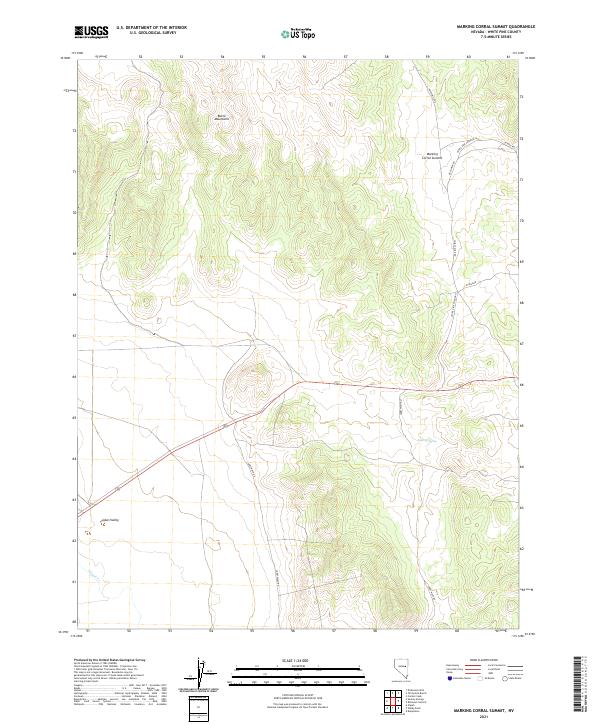
2021 Map of Marking Corral Summit
USGS Topo · Published 2021About this map
The Butte Mountains dominate the northwestern portion of this terrain, giving way to the broad expanse of Jakes Valley to the south. This White Pine County landscape is defined by its arid, high-elevation character, where water sources like Summit Spring and the drainage of Illipah Cr provide critical points of reference in a largely open environment. The mapping reveals a sparse but deliberate network of high-desert thoroughfares, including the descriptively named Thirtymile Rd and 30 Mile Rd, which skirt the edges of the mountains.
Find a feature on this map
16 named features on this map. Tap any name to fly to it.
Don’t see what you’re looking for? This feature index may not catch every label — zoom into the map to look around manually.
Map Details
Editions of this 2021 Marking Corral Summit Map
This is the sole edition of this map. No revisions or reprints were ever made.
Other maps of this area

1951 · Illipah
USGS Topo · 1:62,500

1956 · Ely
USGS Topo · 1:250,000

1958 · Reipetown
USGS Topo · 1:24,000

1959 · Ely
USGS Topo · 1:250,000

1959 · Reipetown
USGS Topo · 1:62,500

1963 · Ely
USGS Topo · 1:250,000

1979 · Mt. Hamilton
USGS Topo · 1:100,000

1982 · Dickenson Well
USGS Topo · 1:24,000
1982 · Thirtymile Ranch
USGS Topo · 1:24,000
1982 · Combs Creek
USGS Topo · 1:24,000