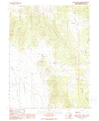
1990 Map of Marking Corral Summit
USGS Topo · Published 1991About this map
The Butte Mountains and the Egan Range dominate this high-altitude landscape of eastern White Pine County. At the center of the sheet, Marking Corral Summit serves as a key topographical divide, overlooking the broad expanse of the Jakes Valley Depression. This region is characterized by its reliance on isolated water sources and ranching infrastructure, as evidenced by Robbers Roost Well, Townsend Well, and the Townsend Reservoir. The presence of several Prospect sites and an Adit near the central peaks hints at the area's history of mineral exploration. Transport in this era relied on rugged tracks and service routes including Thirtymile Road, Bothwick Road, and the Lower Road, while a prominent Trans Line and Water Tank mark the gradual introduction of modern utility networks across the high desert terrain.
Find a feature on this map
17 named features on this map. Tap any name to fly to it.
Don’t see what you’re looking for? This feature index may not catch every label — zoom into the map to look around manually.
Map Details
Editions of this 1990 Marking Corral Summit Map
This is the sole edition of this map. No revisions or reprints were ever made.
Other maps of this area

1951 · Illipah
USGS Topo · 1:62,500

1956 · Ely
USGS Topo · 1:250,000

1958 · Reipetown
USGS Topo · 1:24,000

1959 · Ely
USGS Topo · 1:250,000

1959 · Reipetown
USGS Topo · 1:62,500

1963 · Ely
USGS Topo · 1:250,000

1979 · Mt. Hamilton
USGS Topo · 1:100,000

1982 · Dickenson Well
USGS Topo · 1:24,000
1982 · Thirtymile Ranch
USGS Topo · 1:24,000
1982 · Combs Creek
USGS Topo · 1:24,000