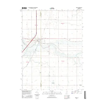
2016 Map of Markle
USGS Topo · Published 2016About this map
The Wabash River carves through the center of this landscape, defining the character of the town of Markle and the surrounding borderlands of Huntington and Wells counties. This 2016 survey shows a region deeply shaped by its drainage network, where natural waterways like Rock Creek and Flat Cr are supplemented by an intricate system of man-made channels such as Griffin Ditch and Redding Ditch. These features reflect the long-standing agricultural focus of the area, facilitating the productivity of the plains surrounding the river valley.
Find a feature on this map
34 named features on this map. Tap any name to fly to it.
Don’t see what you’re looking for? This feature index may not catch every label — zoom into the map to look around manually.
Map Details
Editions of this 2016 Markle Map
This is the sole edition of this map. No revisions or reprints were ever made.
Other maps of this area

1950 · Warren
USGS Topo · 1:24,000

1952 · Warren
USGS Topo · 1:24,000

1952 · Majenica
USGS Topo · 1:24,000

1953 · Muncie
USGS Topo · 1:250,000

1955 · Markle
USGS Topo · 1:24,000

1956 · Muncie
USGS Topo · 1:250,000

1956 · Huntington
USGS Topo · 1:24,000
1961 · Zanesville
USGS Topo · 1:24,000

1962 · Uniondale
USGS Topo · 1:24,000

1962 · Ossian
USGS Topo · 1:24,000