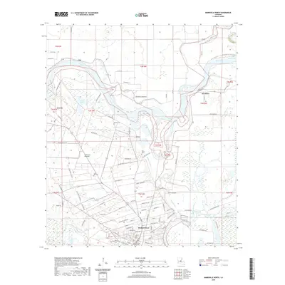
2020 Map of Marksville North
USGS Topo · Published 2020About this map
The Avoyelles Parish Courthouse stands as the civic anchor of Marksville, surrounded by a landscape defined by the shifting course of the Red River. This modern survey reveals the intricate water network of the Prairie des Avoyelles, where the Saline Cutoff and Old Red River trace former channels through the lowlands. The area's history is deeply etched into its geography, from the Fort Derussy Cem north of the city to the various family and community burial grounds like Cushman Cem and Bordelon Cem. Smaller settlements such as Vick, Moncla, and Brouillette are connected by a web of local roads including Reynaud Rd and Wheeler Rd. The map also captures the complex hydrology of the region, featuring Lac de Johnson, Bayou Johnson, and Spring Bayou, illustrating how water continues to shape the settlement patterns and land use in this part of Louisiana.
Find a feature on this map
101 named features on this map. Tap any name to fly to it.
Don’t see what you’re looking for? This feature index may not catch every label — zoom into the map to look around manually.
Map Details
Editions of this 2020 Marksville North Map
This is the sole edition of this map. No revisions or reprints were ever made.
Other maps of this area

1935 · Tooleys
USGS Topo · 1:62,500

1940 · Marksville
USGS Topo · 1:62,500

1941 · Voorhies
USGS Topo · 1:62,500

1941 · Buckeye
USGS Topo · 1:62,500

1941 · Tooleys
USGS Topo · 1:62,500

1953 · Alexandria
USGS Topo · 1:250,000

1953 · Natchez
USGS Topo · 1:250,000

1955 · Alexandria
USGS Topo · 1:250,000

1956 · Natchez
USGS Topo · 1:250,000

1959 · Natchez
USGS Topo · 1:250,000