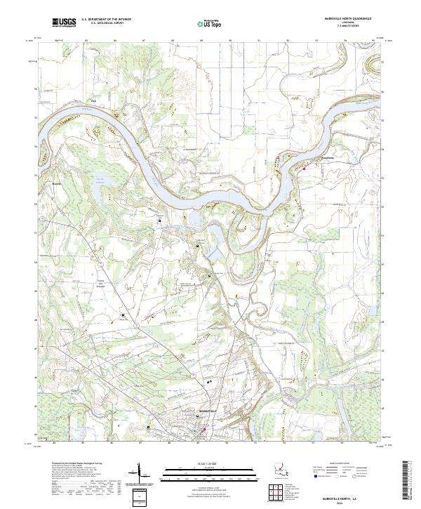
2024 Map of Marksville North
USGS Topo · Published 2024About this map
The Red River carves a winding path across this landscape, defining the northern edge of the Marksville community. The town serves as a prominent focal point, housing the Avoyelles Parish Courthouse and several historical burial grounds including Cushman Cem and Waddill Cem. Northwest of the town center, the terrain opens into the Prairie des Avoyelles, a flat expanse that stands in contrast to the dense network of bayous and wetlands to the east.
Find a feature on this map
184 named features on this map. Tap any name to fly to it.
Don’t see what you’re looking for? This feature index may not catch every label — zoom into the map to look around manually.
Map Details
Editions of this 2024 Marksville North Map
This is the sole edition of this map. No revisions or reprints were ever made.
Other maps of this area

1935 · Tooleys
USGS Topo · 1:62,500

1940 · Marksville
USGS Topo · 1:62,500

1941 · Voorhies
USGS Topo · 1:62,500

1941 · Buckeye
USGS Topo · 1:62,500

1941 · Tooleys
USGS Topo · 1:62,500

1953 · Alexandria
USGS Topo · 1:250,000

1953 · Natchez
USGS Topo · 1:250,000

1955 · Alexandria
USGS Topo · 1:250,000

1956 · Natchez
USGS Topo · 1:250,000

1959 · Natchez
USGS Topo · 1:250,000