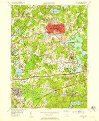
1953 Map of Marlboro
USGS Topo · Published 1958About this map
Marlboro and its surrounding villages stand as a focal point of rail and water infrastructure during the mid-century transition of the Worcester and Middlesex county lines. The landscape is characterized by its heavy investment in education and public institutions, notably the Westborough State Hospital and private campuses like St Marks Sch and Fay Sch in Southboro. This era is defined by the coexistence of traditional industry and modern transportation, as the newly added Massachusetts Turnpike and Worcester Turnpike bisect the older rail corridors of the Boston and Maine Railroad and the Boston and Albany Railroad.
Find a feature on this map
83 named features on this map. Tap any name to fly to it.
Don’t see what you’re looking for? This feature index may not catch every label — zoom into the map to look around manually.
Map Details
Editions of this 1953 Marlboro Map
4 editions found
Other maps of this area

1886 · Blackstone
USGS Topo · 1:62,500

1886 · Framingham
USGS Topo · 1:62,500

1887 · Franklin
USGS Topo · 1:62,500

1887 · Marlboro
USGS Topo · 1:62,500

1889 · Marlboro
USGS Topo · 1:62,500

1889 · Blackstone
USGS Topo · 1:62,500

1889 · Franklin
USGS Topo · 1:62,500

1889 · Framingham
USGS Topo · 1:62,500

1893 · Franklin
USGS Topo · 1:62,500

1893 · Blackstone
USGS Topo · 1:62,500