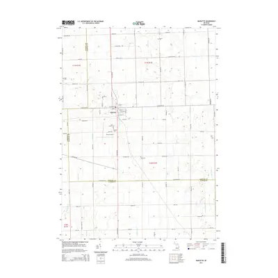
2014 Map of Marlette
USGS Topo · Published 2014About this map
The agricultural landscape of Marlette is defined by a grid of farm roads and drainage systems at the intersection of Sanilac, Tuscola, and Lapeer Counties. This area of the Michigan Thumb exhibits a dense network of water management features like Hillaker Drain, Negus Drain, and Gibbard Drain, which support the surrounding productive fields. The central settlement of Marlette is the primary hub, where residential streets like Ellsworth St and Lamotte St meet the regional corridor of S Van Dyke Rd. Family history is well-preserved across this rural expanse through numerous burial grounds, including the Saint Elizabeth Cem and Marlette Cem near the Marlette Airport, as well as the outlying McLeish Cem and Siple Cem. The eastern portion of the map is dominated by the winding path of the S Br Cass River and Duff Cr, providing a natural contrast to the strictly surveyed section lines.
Find a feature on this map
106 named features on this map. Tap any name to fly to it.
Don’t see what you’re looking for? This feature index may not catch every label — zoom into the map to look around manually.
Map Details
Editions of this 2014 Marlette Map
This is the sole edition of this map. No revisions or reprints were ever made.
Other maps of this area

1954 · Flint
USGS Topo · 1:250,000

1958 · Flint
USGS Topo · 1:250,000

1961 · Brown City
USGS Topo · 1:24,000

1963 · Snover
USGS Topo · 1:24,000

1963 · Clifford
USGS Topo · 1:24,000

1963 · Juhl
USGS Topo · 1:24,000

1963 · Marlette
USGS Topo · 1:24,000

1963 · North Branch
USGS Topo · 1:24,000

1963 · Kingston
USGS Topo · 1:24,000

1963 · Burnside
USGS Topo · 1:24,000