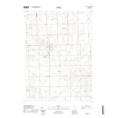
2019 Map of Marlette
USGS Topo · Published 2019About this map
The city of Marlette serves as the focal point of this agricultural landscape in Michigan's Thumb region, situated where the borders of Sanilac, Tuscola, and Lapeer counties meet. This survey shows the intricate network of water management features essential to the local drainage system, including the Pattie Vail Drain, Donald Drain, and Governor Drain, which flow toward the S Br Cass River. These engineered waterways reflect the transformation of the terrain for productive farming during the twentieth century. Genealogists will find several burial grounds mapped across the countryside, such as Saint Elizabeth Cem, Hager Cem, and Siple Cem. The presence of the Marlette Airport and the grid of section roads like Frenchline Rd and Montgomery Rd illustrate the modern transportation framework supporting this rural community and its surrounding townships.
Find a feature on this map
66 named features on this map. Tap any name to fly to it.
Don’t see what you’re looking for? This feature index may not catch every label — zoom into the map to look around manually.
Map Details
Editions of this 2019 Marlette Map
This is the sole edition of this map. No revisions or reprints were ever made.
Other maps of this area

1954 · Flint
USGS Topo · 1:250,000

1958 · Flint
USGS Topo · 1:250,000

1961 · Brown City
USGS Topo · 1:24,000

1963 · Snover
USGS Topo · 1:24,000

1963 · Clifford
USGS Topo · 1:24,000

1963 · Juhl
USGS Topo · 1:24,000

1963 · Marlette
USGS Topo · 1:24,000

1963 · North Branch
USGS Topo · 1:24,000

1963 · Kingston
USGS Topo · 1:24,000

1963 · Burnside
USGS Topo · 1:24,000