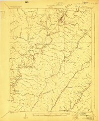
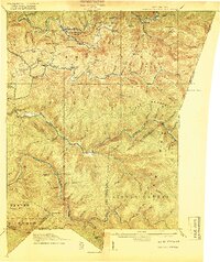
1923 Map of Marlinton
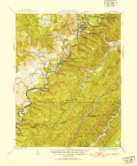
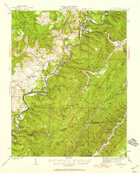
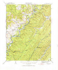
USGS Topo · Published 1953About this map
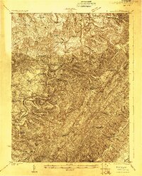
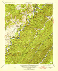
The Greenbrier River winds through the heart of Pocahontas County, defining the valley between Marlin Mountain and the high plateaus of the Monongahela National Forest. In the early 1920s, the Chesapeake and Ohio railroad corridor followed the river's path, connecting riverside settlements like Seebert, Watoga, and Denmar. The landscape reflects a diverse mountain economy, from the valley farms of the Little Levels near Hillsboro to the industrial timber operations indicated by the Lumber RR and Douthat Lumber RR branching into the ridges. Dozens of rural schoolhouses, including Beaverdam School, Buck Run School, and North Fork School, are scattered across the terrain, marking the social centers of these isolated upland communities before the consolidation of the modern era. The presence of the Locust PO and numerous family-named runs and hollows provides a detailed record of local genealogy and historic land use.
Find a feature on this map
118 named features on this map. Tap any name to fly to it.
Don’t see what you’re looking for? This feature index may not catch every label — zoom into the map to look around manually.
Map Details
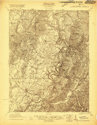
Editions of this 1923 Marlinton Map
6 editions found
Other maps of this area

1887 · Lewisburg
USGS Topo · 1:125,000

1891 · Lewisburg
USGS Topo · 1:125,000

1891 · Huntersville
USGS Topo · 1:125,000

1894 · Huntersville
USGS Topo · 1:125,000

1894 · Natural Bridge
USGS Topo · 1:125,000

1901 · Monterey
USGS Topo · 1:125,000

1915 · Webster Springs
USGS Topo · 1:48,000
1918 · Webster Springs
USGS Topo · 1:62,500

1921 · Callaghan
USGS Topo · 1:48,000
1921 · White Sulphur Springs
USGS Topo · 1:48,000