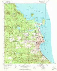
1954 Map of Marquette
USGS Topo · Published 1972About this map
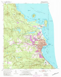
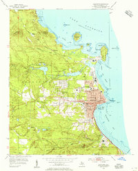
Marquette serves as a vital Upper Peninsula hub in this mid-century survey, where industrial and educational landscapes meet the shores of Lake Superior. The city's northern edge is dominated by the extensive recreational grounds of Presque Isle Park and the specialized infrastructure of Presque Isle Harbor. To the south, the Marquette State Prison and the Marquette City Boundary frame the urban extent near the Carp River. Local education and healthcare are well-documented, featuring Northern Michigan College, St Luke Hospital, and numerous schools like Graveraet High Sch. Transportation networks are clearly defined by the Duluth South Shore and Atlantic railroad and the L S & I, illustrating how iron and timber moved through the region. Landform features like Mount Mesnard and Sugarloaf Mountain provide a clear view of the area's transition from harbor to highland.
Find a feature on this map
80 named features on this map. Tap any name to fly to it.
Don’t see what you’re looking for? This feature index may not catch every label — zoom into the map to look around manually.
Map Details
Editions of this 1954 Marquette Map
6 editions found
Other maps of this area

1907 · Marquette
USGS Topo · 1:62,500

1932 · Harvey NW
USGS Topo · 1:31,680

1932 · Harvey NE
USGS Topo · 1:31,680

1952 · Sands
USGS Topo · 1:24,000

1952 · Ishpeming
USGS Topo · 1:62,500

1952 · Gwinn
USGS Topo · 1:62,500

1952 · Palmer
USGS Topo · 1:24,000

1953 · Marquette NW
USGS Topo · 1:24,000

1953 · Negaunee
USGS Topo · 1:24,000
1954 · Marquette
USGS Topo · 1:24,000
Featured Places
- Marquette, MI
- Trowbridge Park, MI
- Negaunee Township, MI
- Brookton Corners, Marquette
- Marquette Township, MI