
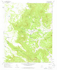
1961 Map of Marquez
USGS Topo · Published 1963About this map
Marquez sits at the heart of this high-altitude landscape, where the Cem and local structures are clustered near the confluence of Arroyo Hondo and Cañon de Marquez. This 1961 field-checked survey reveals a complex network of canyons and mesas defined by the Cebolleta range. Water sources are critical identifiers across this arid terrain, with numerous springs and tanks such as Ojo Marquez, Ojo de las Primallas, and Ojo Tecolote Springs serving the scattered ranching interests.
Find a feature on this map
58 named features on this map. Tap any name to fly to it.
Don’t see what you’re looking for? This feature index may not catch every label — zoom into the map to look around manually.
Map Details
Editions of this 1961 Marquez Map
2 editions found
Other maps of this area

1883 · Mt. Taylor
USGS Topo · 1:250,000

1886 · Mt. Taylor
USGS Topo · 1:250,000

1892 · Mt. Taylor
USGS Topo · 1:250,000

1899 · Mt. Taylor
USGS Topo · 1:250,000

1957 · Moquino
USGS Topo · 1:24,000

1957 · Seboyeta
USGS Topo · 1:24,000
1957 · Arch Mesa
USGS Topo · 1:24,000

1958 · Albuquerque
USGS Topo · 1:250,000

1961 · Cerro Tinaja
USGS Topo · 1:24,000

1961 · El Dado Mesa
USGS Topo · 1:24,000