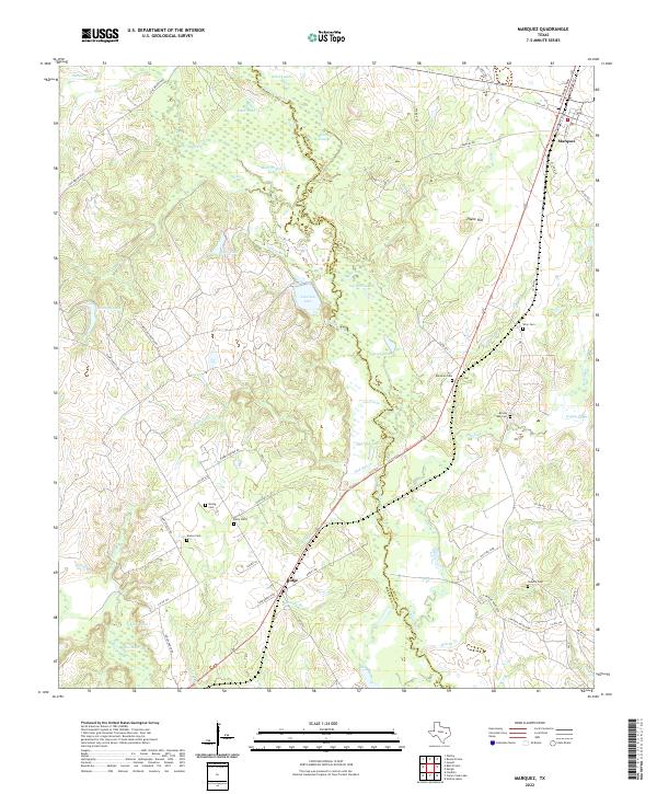
2022 Map of Marquez
USGS Topo · Published 2022About this map
The Navasota River meanders through a network of wetlands and oxbows along the boundary between Robertson and Leon counties. This landscape is defined by its complex hydrography, where named water bodies like Brushy Lake, Wolf Lake, and Artesian Lake occupy the lowlands surrounding the river's main channel. The settlement of Marquez serves as a local hub in the northeast, while the smaller community of Ridge sits further south along the rail corridor. For local historians and genealogists, the area is notably dense with family and community burial grounds, including Winn Cem, Bateman Cem, and Kaster Cem. Rising above the river bottom, Payne Hill and the surrounding higher ground are crisscrossed by a network of rural routes such as Camp Cooley Ranch Rd and Wheel Corner Rd, reflecting a landscape primarily shaped by cattle ranching and scattered agricultural homesteads.
Find a feature on this map
70 named features on this map. Tap any name to fly to it.
Don’t see what you’re looking for? This feature index may not catch every label — zoom into the map to look around manually.
Map Details
Editions of this 2022 Marquez Map
This is the sole edition of this map. No revisions or reprints were ever made.
Other maps of this area

1925 · Marquez No. 1
USGS Topo · 1:48,000

1925 · Marquez No. 4
USGS Topo · 1:48,000

1927 · Marquez
USGS Topo · 1:62,500

1930 · Marquez
USGS Topo · 1:62,500

1954 · Waco
USGS Topo · 1:250,000

1955 · Waco
USGS Topo · 1:250,000

1956 · Jewett
USGS Topo · 1:62,500
1964 · Hilltop Lakes
USGS Topo · 1:24,000

1964 · Margie
USGS Topo · 1:24,000

1965 · Jewett
USGS Topo · 1:24,000