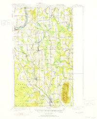
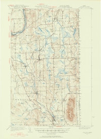
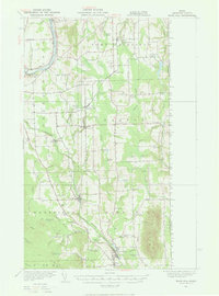
1951 Map of Mars Hill
USGS Topo · Published 1952About this map
The Bangor And Aroostook railroad defines the industrial and agricultural corridors of eastern Aroostook County in the mid-20th century. This terrain is marked by the prominent rise of Mars Hill Mountain and the winding course of the Prestile Brook, which supports a network of small settlements including Westfield, Blaine, and the town of Easton. Along the international boundary with New Brunswick, the map records essential infrastructure of the era, such as the U S Customs station and the Ladner Sch.
Find a feature on this map
68 named features on this map. Tap any name to fly to it.
Don’t see what you’re looking for? This feature index may not catch every label — zoom into the map to look around manually.
Map Details
Editions of this 1951 Mars Hill Map
3 editions found
Other maps of this area

1929 · Caribou
USGS Topo · 1:48,000

1930 · Fort Fairfield
USGS Topo · 1:48,000

1932 · Caribou
USGS Topo · 1:62,500

1933 · Fort Fairfield
USGS Topo · 1:62,500

1934 · Bridgewater
USGS Topo · 1:48,000

1935 · Howe Brook
USGS Topo · 1:48,000

1935 · Presque Isle
USGS Topo · 1:62,500

1936 · Mars Hill
USGS Topo · 1:48,000

1938 · Bridgewater
USGS Topo · 1:62,500

1939 · Howe Brook
USGS Topo · 1:62,500