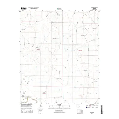
2014 Map of Marsden
USGS Topo · Published 2014About this map
The lowlands of the Ouachita River basin define this southern Arkansas landscape, where numerous ridges and prairies rise above a network of winding creeks and sluices. The settlement of Marsden serves as a central point, surrounded by a high density of rural burial grounds that speak to the area's family history, including Marsden Cem, Weary Rest Cem, and Lyns Cem. The terrain is characterized by distinct topographic rises such as Sand Ridge, Hayes Ridge, and Hogpen Ridge, which provide higher ground amidst the wetlands of Gar Lake and White Oak Lake. A complex system of county roads, such as Bradley 157 Rd and Bradley 4 Rd, connects these ridges and local landmarks. This survey illustrates the traditional land use patterns of Bradley County, where the transition between river bottomlands and elevated prairies like Pine Prairie dictated the placement of homesteads and cemeteries.
Find a feature on this map
79 named features on this map. Tap any name to fly to it.
Don’t see what you’re looking for? This feature index may not catch every label — zoom into the map to look around manually.
Map Details
Editions of this 2014 Marsden Map
This is the sole edition of this map. No revisions or reprints were ever made.
Other maps of this area

1933 · Strong
USGS Topo · 1:62,500

1934 · Ingalls
USGS Topo · 1:48,000

1934 · Felsenthal
USGS Topo · 1:62,500

1934 · Moro Bay
USGS Topo · 1:62,500

1937 · Strong
USGS Topo · 1:62,500

1937 · Felsenthal
USGS Topo · 1:62,500

1937 · Ingalls
USGS Topo · 1:62,500

1938 · Felsenthal
USGS Topo · 1:62,500

1938 · Moro Bay
USGS Topo · 1:62,500

1939 · Felsenthal
USGS Topo · 1:62,500