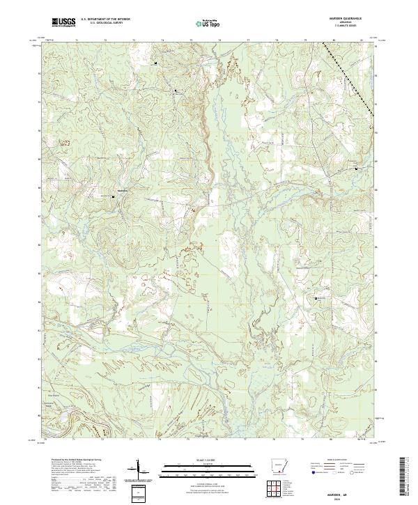
2024 Map of Marsden
USGS Topo · Published 2024About this map
L'Aigle Creek and its many tributaries, including Mill Branch, define the bottomland landscape of this Bradley County region. The community of Marsden serves as a central point in an area characterized by a series of distinct geographic rises, such as Sand Ridge, Hayes Ridge, and Hurricane Ridge. To the south, the map reveals the transition into the Felsenthal National Wildlife Refuge, where the terrain drops toward the Ouachita River and is marked by wetlands like White Oak Lake and Gar Lake. Genealogists will find several family and community burial sites scattered across the landscape, including the Marsden Cem, Weary Rest Cem, and the Anderson - York Cem. The map illustrates a complex network of local roads and creek crossings, such as Tulip Creek and Charivari Creek, that historically connected the rural homesteads of southern Arkansas.
Find a feature on this map
88 named features on this map. Tap any name to fly to it.
Don’t see what you’re looking for? This feature index may not catch every label — zoom into the map to look around manually.
Map Details
Editions of this 2024 Marsden Map
This is the sole edition of this map. No revisions or reprints were ever made.
Other maps of this area

1933 · Strong
USGS Topo · 1:62,500

1934 · Ingalls
USGS Topo · 1:48,000

1934 · Felsenthal
USGS Topo · 1:62,500

1934 · Moro Bay
USGS Topo · 1:62,500

1937 · Strong
USGS Topo · 1:62,500

1937 · Felsenthal
USGS Topo · 1:62,500

1937 · Ingalls
USGS Topo · 1:62,500

1938 · Felsenthal
USGS Topo · 1:62,500

1938 · Moro Bay
USGS Topo · 1:62,500

1939 · Felsenthal
USGS Topo · 1:62,500