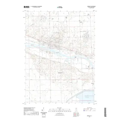
2021 Map of Marseilles
USGS Topo · Published 2021About this map
The Illinois River and its accompanying Marseilles Canal dominate this landscape, illustrating the critical role of water-borne transit and power in LaSalle County. The city of Marseilles is positioned along the northern bank, where the Great Falls of the Illinois River once presented a natural obstacle and an industrial opportunity. Local geography is defined by a series of river islands, including Bells Island, Clarks Island, and Johnson Island, while the southern reaches are marked by the massive LaSalle County Nuclear Station Cooling Pond. Genealogists will find a significant concentration of burial sites scattered throughout the rural uplands, such as the Old Brumbach Cem, Nichol Cem, and the Maxton and Woodside Cem. Small-scale aviation is represented by several private strips like the David Gillespie Airport and Mitchell RLA Airport, showing how the mid-century regional infrastructure evolved into the modern era.
Find a feature on this map
79 named features on this map. Tap any name to fly to it.
Don’t see what you’re looking for? This feature index may not catch every label — zoom into the map to look around manually.
Map Details
Editions of this 2021 Marseilles Map
This is the sole edition of this map. No revisions or reprints were ever made.
Other maps of this area

1892 · Marseilles
USGS Topo · 1:62,500

1892 · Ottawa
USGS Topo · 1:62,500

1915 · Ottawa
USGS Topo · 1:62,500

1916 · Marseilles
USGS Topo · 1:62,500

1925 · Streator
USGS Topo · 1:62,500

1927 · Streator
USGS Topo · 1:62,500

1940 · Marseilles
USGS Topo · 1:62,500

1946 · Ottawa
USGS Topo · 1:62,500

1958 · Odell
USGS Topo · 1:62,500

1958 · Aurora
USGS Topo · 1:250,000