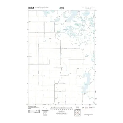
2010 Map of Marsh-Miller Lake
USGS Topo · Published 2010About this map
Marsh-Miller Lake dominates the southeastern corner of this landscape, its waters held back by the Hansons 2WP792 Dam. The area is defined by an intricate network of kettle lakes and smaller water bodies, including Two Island Lake, North Shattuck Lake, and Salisbury Lake. This glacial terrain is characterized by numerous recreational camps, such as Camp Manitou and Camp Pokonokah Hills, which line the shores of the northern lakes.
Find a feature on this map
77 named features on this map. Tap any name to fly to it.
Don’t see what you’re looking for? This feature index may not catch every label — zoom into the map to look around manually.
Map Details
Editions of this 2010 Marsh-Miller Lake Map
This is the sole edition of this map. No revisions or reprints were ever made.
Other maps of this area

1948 · Weyerhauser
USGS Topo · 1:48,000

1949 · Bloomer
USGS Topo · 1:62,500

1949 · New Auburn
USGS Topo · 1:62,500

1950 · Weyerhauser
USGS Topo · 1:48,000

1951 · Bloomer
USGS Topo · 1:62,500

1951 · New Auburn
USGS Topo · 1:62,500

1951 · Chetek
USGS Topo · 1:62,500

1953 · Rice Lake
USGS Topo · 1:250,000

1959 · Rice Lake
USGS Topo · 1:250,000
1972 · Fireside Lakes
USGS Topo · 1:24,000