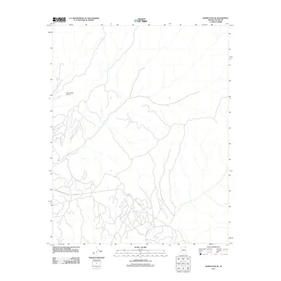
2011 Map of Marsh Pass SE
USGS Topo · Published 2011About this map
Yellow Water Canyon dominates the northwestern landscape of this Navajo County terrain, where the topography is defined by the industrial infrastructure of the early 21st century. The presence of the Peabody Western Coal Haul Rd and the adjacent Haulage Rd underscores the region's role in resource extraction and heavy logistics. In a landscape where water is a critical marker, Pine Spring stands out as a named source in the northern reaches, contrasting with the expansive network of unpaved paths like Main Rd that crisscross the high desert floor. This 2011 survey illustrates the intersection of natural drainage systems and the large-scale transit routes required for regional mining operations.
Find a feature on this map
5 named features on this map. Tap any name to fly to it.
Don’t see what you’re looking for? This feature index may not catch every label — zoom into the map to look around manually.
Map Details
Editions of this 2011 Marsh Pass SE Map
This is the sole edition of this map. No revisions or reprints were ever made.
Other maps of this area

1883 · Marsh Pass
USGS Topo · 1:250,000

1892 · Marsh Pass
USGS Topo · 1:250,000

1956 · Marble Canyon
USGS Topo · 1:250,000

1959 · Marble Canyon
USGS Topo · 1:250,000

1961 · Marble Canyon
USGS Topo · 1:250,000
1968 · Kayenta East
USGS Topo · 1:24,000
1968 · Kayenta West
USGS Topo · 1:24,000

1968 · Marsh Pass
USGS Topo · 1:24,000
1968 · Owl Spring
USGS Topo · 1:24,000

1968 · Yucca Hill
USGS Topo · 1:24,000