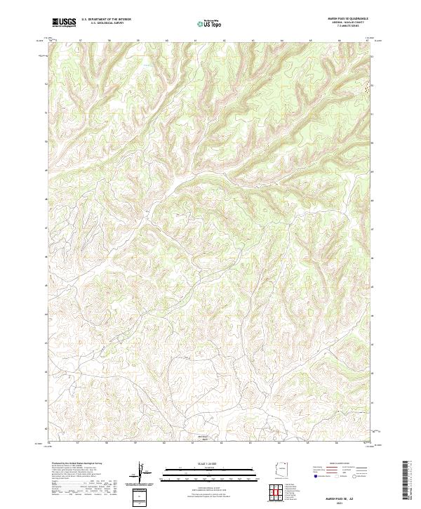
2021 Map of Marsh Pass SE
USGS Topo · Published 2021About this map
Moenkopi Wash winds across the southern reaches of this landscape in Navajo County, marking a vital hydrological feature in a high-elevation arid environment. The terrain is characterized by a series of deep canyons and mesas, where natural water sources like Pine Spring have historically served as critical landmarks for travelers and inhabitants. This 2021 survey by the U.S. Geological Survey details the township and range divisions across the high desert, showing the intricate contour patterns of the rugged landforms that separate the various drainages feeding into the greater wash system. The absence of named settlements or major roads emphasizes the isolated character of this part of northern Arizona, where the physical geography dictates the paths of local travel and land use.
Find a feature on this map
6 named features on this map. Tap any name to fly to it.
Don’t see what you’re looking for? This feature index may not catch every label — zoom into the map to look around manually.
Map Details
Editions of this 2021 Marsh Pass SE Map
This is the sole edition of this map. No revisions or reprints were ever made.
Other maps of this area

1883 · Marsh Pass
USGS Topo · 1:250,000

1892 · Marsh Pass
USGS Topo · 1:250,000

1956 · Marble Canyon
USGS Topo · 1:250,000

1959 · Marble Canyon
USGS Topo · 1:250,000

1961 · Marble Canyon
USGS Topo · 1:250,000
1968 · Kayenta East
USGS Topo · 1:24,000
1968 · Kayenta West
USGS Topo · 1:24,000

1968 · Marsh Pass
USGS Topo · 1:24,000
1968 · Owl Spring
USGS Topo · 1:24,000

1968 · Yucca Hill
USGS Topo · 1:24,000