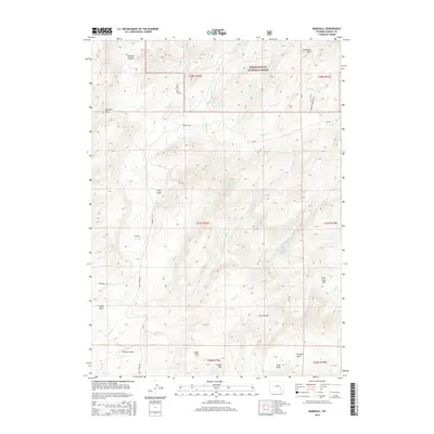
2015 Map of Marshall
USGS Topo · Published 2015About this map
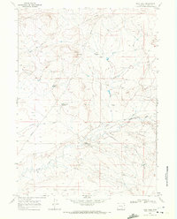
Marshall sits at the heart of this high-elevation landscape in Albany County, where the plains of Wyoming meet the southern reaches of the Medicine Bow National Forest. The map reveals a complex network of drainage and terrain, centered around the Mule Creek Reservoir and the prominent Mule Creek Mtn. The rangeland is defined by numerous draws and creeks, including Old Maids Draw and Parsons Canyon to the north, which suggest the seasonal flow patterns critical to this arid region. Transportation and infrastructure are sparse, dominated by the long stretch of Marshall Rd and the presence of Robbins Airport in the southwest. Geological interest is highlighted by features such as the Mine Hills and Crystal Hill, while the remote character of the area is underscored by landmarks like Post Mule Cr Draw and the high crossing at Cameron Pass.
Find a feature on this map
40 named features on this map. Tap any name to fly to it.
Don’t see what you’re looking for? This feature index may not catch every label — zoom into the map to look around manually.
Map Details
Editions of this 2015 Marshall Map
This is the sole edition of this map. No revisions or reprints were ever made.
Other maps of this area

1954 · Torrington
USGS Topo · 1:250,000

1958 · Torrington
USGS Topo · 1:250,000

1964 · Toltec
USGS Topo · 1:24,000

1964 · School Section Mountain
USGS Topo · 1:24,000
1964 · Rock Creek
USGS Topo · 1:24,000
1964 · Pass Creek
USGS Topo · 1:24,000

1964 · Marshall
USGS Topo · 1:24,000
1964 · Warbonnet Peak
USGS Topo · 1:24,000

1968 · Cottonwood Creek
USGS Topo · 1:24,000
1968 · Boot Heel
USGS Topo · 1:24,000