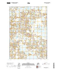
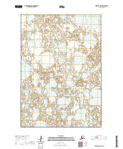
2020 Map of Marshall C-5 NW
USGS Topo · Published 2020About this map
The T19n R80w and T19n R81w townships define this portion of the Kusilvak Census Area in western Alaska. Mapped by the U.S. Geological Survey in 2020, this 1:25,000 scale quadrangle illustrates the intricate hydrography and terrain characteristic of the region. The area, spanning across T18n R81w and T18n R80w, is part of a network of public lands where precise surveying is essential for land management and environmental study. The 2020 data provides a contemporary look at the topographical features of this Alaskan landscape, though specific named landmarks are sparse within these particular coordinates. The map serves as a technical tool for understanding the geographic layout and administrative divisions of this specific section of the Alaskan wilderness.
Find a feature on this map
4 named features on this map. Tap any name to fly to it.
Don’t see what you’re looking for? This feature index may not catch every label — zoom into the map to look around manually.
Map Details
Editions of this 2020 Marshall C-5 NW Map
This is the sole edition of this map. No revisions or reprints were ever made.
Other maps of this area

1951 · Marshall
USGS Topo · 1:250,000

1952 · Marshall D-5
USGS Topo · 1:63,360

1952 · Marshall C-6
USGS Topo · 1:63,360

1952 · Marshall C-5
USGS Topo · 1:63,360

1952 · Marshall D-6
USGS Topo · 1:63,360

1954 · Marshall
USGS Topo · 1:250,000
2020 · Marshall D-5 SE
USGS Topo · 1:25,000
2020 · Marshall C-6 SE
USGS Topo · 1:25,000
2020 · Marshall C-5 SE
USGS Topo · 1:25,000
2020 · Marshall C-5 NE
USGS Topo · 1:25,000