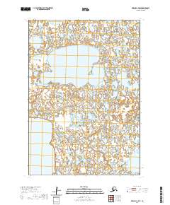
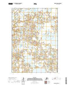
2020 Map of Marshall C-5 SE
USGS Topo · Published 2020About this map
Kingaglia Lake dominates the upper central portion of this remote Alaskan terrain, where the landscape is defined by an intricate network of wetlands and small water bodies. This 2020 U.S. Geological Survey topographic map provides a precise view of the Kusilvak Census Area's hydrologic patterns, including the expansive Kgun Lake at the southwestern edge. The map captures a largely untouched wilderness within the Public Land Survey System grids of t17n r79w and t18n r79w, illustrating the complex drainage and seasonal variability of the northern marshlands. For researchers or outdoor enthusiasts, this survey reveals the absence of man-made infrastructure, emphasizing the raw character of the Alaskan tundra.
Find a feature on this map
8 named features on this map. Tap any name to fly to it.
Don’t see what you’re looking for? This feature index may not catch every label — zoom into the map to look around manually.
Map Details
Editions of this 2020 Marshall C-5 SE Map
This is the sole edition of this map. No revisions or reprints were ever made.
Other maps of this area

1951 · Marshall
USGS Topo · 1:250,000

1952 · Marshall C-5
USGS Topo · 1:63,360

1953 · Marshall B-5
USGS Topo · 1:63,360

1954 · Marshall B-4
USGS Topo · 1:63,360

1954 · Marshall C-4
USGS Topo · 1:63,360

1954 · Marshall
USGS Topo · 1:250,000
2020 · Marshall B-4 NW
USGS Topo · 1:25,000
2020 · Marshall B-5 NW
USGS Topo · 1:25,000
2020 · Marshall C-5 NE
USGS Topo · 1:25,000
2020 · Marshall C-5 NW
USGS Topo · 1:25,000