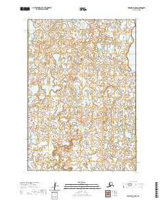
2020 Map of Marshall B-5 NW
USGS Topo · Published 2020About this map
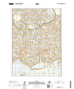
The hydrological character of the Kusilvak Census Area defines this 2020 topographic study, which focuses on a dense network of wetlands and seasonal water bodies typical of the Alaska delta landscape. In the northeast corner of the quadrangle, Kgun Lake serves as the primary named geographical marker amidst a complex of unnamed ponds and intricate shorelines. This map represents a contemporary digital record produced by the U.S. Geological Survey based on data from the National Hydrography Dataset and the National Elevation Dataset. The lack of named roads or established settlements on this sheet highlights the isolation of this tundra environment, where public land surveying by the Bureau of Land Management is organized within the boundaries of t16n r81w and t16n r80w.
Find a feature on this map
5 named features on this map. Tap any name to fly to it.
Don’t see what you’re looking for? This feature index may not catch every label — zoom into the map to look around manually.
Map Details
Editions of this 2020 Marshall B-5 NW Map
This is the sole edition of this map. No revisions or reprints were ever made.
Other maps of this area

1951 · Marshall
USGS Topo · 1:250,000

1952 · Marshall C-6
USGS Topo · 1:63,360

1952 · Marshall C-5
USGS Topo · 1:63,360

1953 · Marshall B-6
USGS Topo · 1:63,360

1953 · Marshall B-5
USGS Topo · 1:63,360

1954 · Marshall
USGS Topo · 1:250,000
2020 · Marshall B-6 SE
USGS Topo · 1:25,000
2020 · Marshall C-6 SE
USGS Topo · 1:25,000
2020 · Marshall C-5 SE
USGS Topo · 1:25,000
2020 · Marshall B-5 SE
USGS Topo · 1:25,000