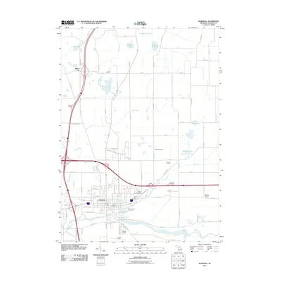
2011 Map of Marshall
USGS Topo · Published 2011About this map
The Kalamazoo River and its tributaries, Rice Creek and Talmadge Creek, shape the settlement patterns of this Calhoun County landscape. In the early 21st century, Marshall serves as the regional hub, characterized by a dense grid of streets like N Marshall Ave and historic institutions such as the Marshall Post Office and the Calhoun County Fairgrounds. The town is surrounded by a network of rural roads named with a distinct alphanumeric system, including 18 Mile Rd and O Drive N, which connect scattered homesteads and various family burial grounds.
Find a feature on this map
82 named features on this map. Tap any name to fly to it.
Don’t see what you’re looking for? This feature index may not catch every label — zoom into the map to look around manually.
Map Details
Editions of this 2011 Marshall Map
This is the sole edition of this map. No revisions or reprints were ever made.
Other maps of this area

1918 · Battle Creek
USGS Topo · 1:62,500

1918 · Union City
USGS Topo · 1:62,500

1921 · Marshall
USGS Topo · 1:62,500

1923 · Marshall
USGS Topo · 1:62,500

1943 · Battle Creek
USGS Topo · 1:62,500

1943 · Marshall
USGS Topo · 1:62,500

1947 · Bellevue
USGS Topo · 1:24,000

1947 · Ceresco
USGS Topo · 1:24,000

1947 · Union City
USGS Topo · 1:62,500

1948 · Homer
USGS Topo · 1:62,500